Òbrôzk:Andorra - Location Map (2013) - AND - UNOCHA.svg

Pierwòtny lopk (Lopk SVG, nominalno 254 × 254 pikslów, miara lopka: 830 KB)
_-_AND_-_UNOCHA.svg)
Òpisënk
| Òpisënk |
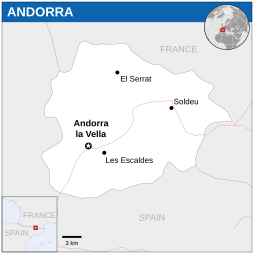
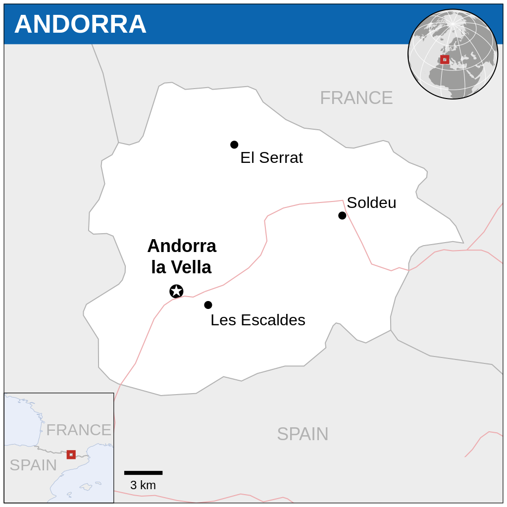
English: Locator map of Andorra. |
| Datum | |
| Zdrój |
English: Andorra Locator Map (ReliefWeb), ESRI, UNCS |
| Aùtor | |
| SVG rozwój |
Licencëjô
- Mòżesz:
- dzélëc sã – kòpirowac, rozprowôdzac, ódtwarzac ùsôdztwò
- zmieniwac – ùsôdzac zanôléżné ùsôdztwa
- Na nôslédnych warunkach:
- ùznanié ùsôdztwa – Ùsôdztwò je nót nacéchòwac na ôrt òpisóny przez ùsôdzcã abò licencjodawcã.
 This map is part of a collection of 216 free country maps, created by the UN Office for the Coordination of Humanitarian Affairs (OCHA), to be used in print, web or broadcast products.
The ReliefWeb Location Maps released here are maps that highlight a country, its capital, major populated places and the surrounding regions. Attribution Requirements
Using the map without modifications: ensure that the sources and the disclaimer are below the map. Credit as follows: "Credit: OCHA". For use with alteration: remove the OCHA logo and disclaimer following any modification to the map, but keep the data sources as mentioned below the map. Credit the modified map as follows: "Based on OCHA map". You are responsible for the content of your map. We are keen to receive your feedback and hear how you used OCHA's maps. We would be grateful if you would notify us by e-mail and share your work with us. UN Disclaimer
The designations employed and the presentation of material of this map do not imply the expression of any opinion whatsoever on the part of the Secretariat of the United Nations concerning the legal status of any country, territory, city or area or of its authorities or concerning the delimitation of its frontiers or boundaries. |
Historëjô lopka
Klëkni na datum/czas, abë òbaczëc jak wëzdrzôł lopk w tim czasu.
| Datum/Czas | Miniatura | Miara | Brëkòwnik | Òpisënk | |
|---|---|---|---|---|---|
| aktualny | 01:46, 19 lës 2022 | | 254 × 254 (830 KB) | Pengetik-AM | File uploaded using svgtranslate tool (https://svgtranslate.toolforge.org/). Added translation for id. |
| 18:17, 1 str 2021 |  | 254 × 254 (830 KB) | Trần Nguyễn Minh Huy | File uploaded using svgtranslate tool (https://svgtranslate.toolforge.org/). Added translation for vi. | |
| 05:15, 29 lës 2018 |  | 254 × 254 (831 KB) | GermanJoe | Consistent color scheme within series of locator maps. | |
| 05:00, 29 lës 2018 |  | 1000 × 1000 (927 KB) | GermanJoe | Reverted to version as of 00:24, 10 December 2014 (UTC) Commons:Watermarks | |
| 05:20, 13 Séw 2017 |  | 254 × 254 (876 KB) | Naikiw | ||
| 02:24, 10 gòd 2014 |  | 1000 × 1000 (927 KB) | Nafsadh | rm logo and use conventional colors | |
| 22:41, 24 gro 2014 |  | 254 × 254 (876 KB) | Jeremyb | xslt v2b | |
| 06:49, 10 gro 2014 |  | 250 × 250 (2,1 MB) | Pharos | restore top | |
| 06:46, 10 gro 2014 |  | 250 × 250 (2,05 MB) | Pharos | remove whitespace + text | |
| 23:59, 12 lës 2013 |  | 254 × 280 (1,97 MB) | Pharos | User created page with UploadWizard |
Lënczi do lopka
Hewò są starnë, jaczé òdwòłëją sã do negò lopka:
Globalné wëzwëskanié lopka
Nene lopk je téż brëkòwnóny w jinnych ùdbach Wiki:
- Wëzwëskanié w az.wiktionary.org
- Wëzwëskanié w bh.wikipedia.org
- Wëzwëskanié w en.wikipedia.org
- Wëzwëskanié w id.wikipedia.org
- Wëzwëskanié w mni.wikipedia.org
- Wëzwëskanié w sd.wikipedia.org
- Wëzwëskanié w tr.wikipedia.org
- Wëzwëskanié w vi.wikipedia.org
_-_AND_-_UNOCHA.svg)